Route Summary
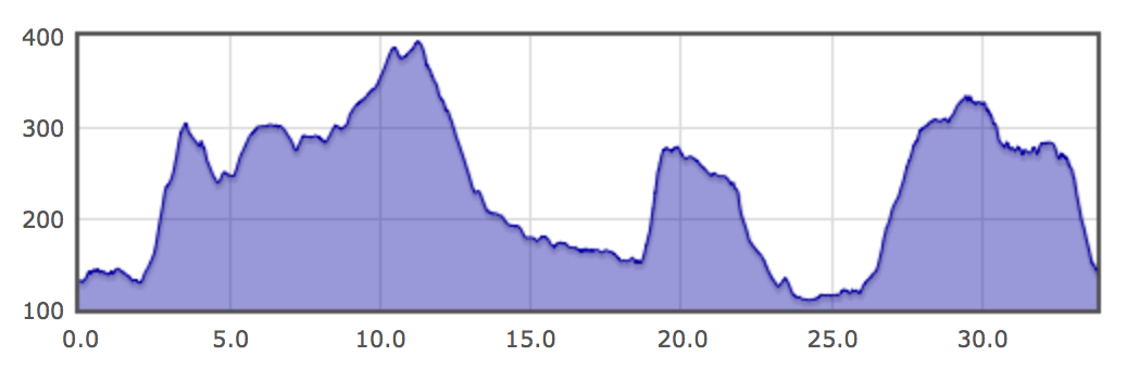
Covering approximately 34 km and 825m of ascent the course takes in the villages of Grindleford, Froggatt, Eyam, Great Longstone, Edensor and Baslow linking them together with paths, tracks and open moorland. Famous landmarks on the way round include the Riley Graves, Longstone Moor, The Monsal Trail and of course the stunning Chatsworth Park estate. The final high-level section along Baslow, Curbar and Froggatt edges offers breath-taking views of the surrounding Peak District.
Race Start Times
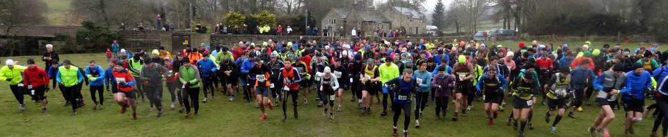
Mass start for main runners at 10am.
After feedback from previous years, we are going to trial optional flexible early start times in 2026 for anyone expecting to take over 4 hours. However, we can’t ask volunteers to open all their checkpoints 2 hours earlier, especially as there are children from the school helping at a lot of them. Please consider your start time carefully and ensure you don’t reach checkpoints before they are open. From extensive number crunching of previous results, here is some guidance:
| Estimated Finish Time | Earliest Start Time | Pace Option |
| < 4 hours | 10am | Mass Start (10am) |
| 4 – 5 hours | 9am | Mid Pace Start (8.30-9.30am) |
| 5 – 6.5 hours | 8.30am | Mid Pace Start (8.30-9.30am) |
| 6.5 – 8 hours | 8am | Relaxed Start (7.30-8.30am) |
| > 8 hours | 7.30am | Relaxed Start (7.30-8.30am) |
If you are at the faster end of a bracket, please start later in the available time slot.
With the exception of V70, prizes will only be allocated from those starting in the mass start at 10am.
Checkpoint Open & Close times
| Start | CP 1 Eyam | CP 2 White Rake | CP 3 Longstone Edge | CP 4 Hassop Station | CP 5 Ballcross Farm | CP 6 Baslow | Finish | |
| Open | Relaxed Start: 7.30-8.30 am Mid Pace Start: 8.30-9.30am Mass start: 10am | 8:00 | 9:45 | 10:00 | 10:45 | 11:00 | 11:30 | |
| Close | 10:45 | 12:00 | 12:30 | 13:30 | 14:00 | 15:00 | 17:00 |
Marshalling and Route finding
The route is marshalled at important interchanges and most of the control points are manned. Elsewhere the route is only partially marked. There are some sections of the route we cannot mark due to landowner requests. Please make yourself familiar with the course using the information on this page and carry a paper map and compass so that you know where you are going. You are encouraged to use GPS devices/ have the route on your watch.
Importantly the route is a fixed course not the shortest route between the controls. That means no short cuts allowed!
Course Help
Detailed routes notes are available here.
A PDF map of the route is available here.
Below is a profile of the course:
You can download a GPX file for navigation devices below.
Kit Requirements
We have a required kit list that is detailed in the terms and conditions when you sign up to the race and on the terms and conditions page.